sábado, 22 de julho de 2017

Arctic summits

Cumes do Ártico – ‘Scandi Peaks 2017’                               

Veni, vidi, subi! Assim foi com cada um dos cumes mais altos dos países escandinavos (fotos em baixo).
‘Cumes do Ártico’ refere-se apenas aos cumes dos países escandinavos (o mais alto de cada país), que se situam próximos do Círculo Polar Ártico. Neste caso, o Hvannadalshnúkur da Islândia (2.110 m), ligeiramente a sul do círculo polar ártico, e o Halti-Haldi da Finlândia (1.331 m) e o Kebnekaise da Suécia (2.111 m), ambos a norte do círculo polar ártico. Poderíamos considerar outros países escandinavos como a Dinamarca e a Noruega mas os seus pontos mais elevados (respetivamente, Mollehoj a 170 metros, e Galdhoppigen a 2.469 m.) encontram-se bastante mais a sul da linha do sol da meia-noite.
O facto de estes cumes, que não são excessivamente elevados, se encontrarem em latitudes tão a norte, confere-lhes um certo grau de dificuldade devido, sobretudo, ao frio e à inconstância (imprevisibilidade) da meteorologia. Se nas minhas subidas a montanhas posso calcular um rácio aproximado de um cume com mau tempo para cada três com bom tempo, no caso dos ‘Cumes do Ártico’ o cenário alterou-se consideravelmente. Vejamos como:
- Na Dinamarca (2017), o Mollehoj, na ilha Sjaelland, exigiu um ‘passeio’ de automóvel de 580 km (ida e volta, desde o aeroporto de Copenhagen), e dois minutos a caminhar, num dia de sol, desde a beira da estrada até chegar a uma ligeira elevação num pequeno bosque encantado.
- Na Noruega (em 2011), o Galdhoppigen, 300 km a NW de Oslo, permitiu-me a aproximação numa magnífica manhã de sol, exigindo umas horas de caminhada em montanha, com neve a partir, talvez, dos 1.800 metros. Mas, no dia seguinte, ao descer do Glitertint (2.468 m, o segundo mais elevado do país e que já foi o mais elevado quando o capacete de gelo que o cobria era mais espesso), no outro lado do vale, a montanha brindou-me com uma molha monumental, daquelas de ter que espremer as meias…
- Na Islândia, o Hvannadalshnúkur (ou ‘Kvana’; lê-se Kvana-dalsh-núkur) criou-me alguma ansiedade: a montanha, cujo cume é o cone de um antigo vulcão extinto, encontra-se rodeada de glaciares em movimento e como tal repleta de gretas instáveis e profundas; ainda paira no ar a história de dois alemães que em 2015 desapareceram sem deixar rasto numa dessas crevasses; várias empresas deixaram de conduzir grupos a esse cume e a única que o faz, fá-lo com um mínimo de 3 pessoas (ou seja dois clientes e um guia, ou um cliente e dois guias). Claro que há rotas mais seguras que outras. Mais ainda se houver bastante neve e esta se encontrar compacta (como era o caso em junho de 2017). Sendo assim, e depois de ter feito os trabalhos de casa e de ter falado com guias locais, parti em solitário. O dia amanheceu bonito. Dos 100 metros de altitude da partida aos 1400 não há problemas. Depois entramos na neve… Aos 1800 metros alcançamos um extenso plateau e é ali que as gretas são mais problemáticas. Como tal há que contornar o problema mas, justamente ao começar a caminhar no plateau, a ‘meteo’ brindou-me com um ‘white out’ total. Visibilidade que chegou a ser de apenas um par de metros… Eu vinha da travessia da Groenlândia, onde tinha navegado naquelas condições, utilizando a bússola, o sol, e até o vento. E assim cheguei àquele cume traiçoeiro sem mais percalços.
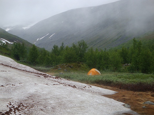
- Na Finlândia (julho de 2017), o Halti-Haldi, ou Haltiatunturi (Halditsohkka em Sami), não constituiu especial problema para além da distância (10 horas e 15 minutos desde o ponto em que acampei, a 600 metros de altitude, e caminhada total de 38,5 km) que percorri. Mas o facto é que esta montanha brindou-me, lá em cima, com um frio cortante, de bastante respeitar.
- Já na Suécia, 5 dias depois de ascender ao Halti, ao chegar à base do Kebnekaise deparei com previsões de empioramento considerável do tempo pelo que, depois de 36 km em bicicleta, resolvi na mesma jornada caminhar os 19 km até ao refúgio de montanha e prosseguir com os 8 km mais até ao cume (e regresso à tenda montada junto do refúgio). O facto é que o tempo se fechou a meio da subida. Mal se via o cume e assim que cheguei lá ao topo, a visibilidade extinguiu-se por completo. Desci a correr para não perder o ‘norte’, que neste caso ficava para sul, e quando cheguei à parte de rocha, pelos 1800 metros, a chuva não me largou até entrar na tenda. Foi uma jornada de 17 horas de duração e 71 km de distância, e mais uma vez, cheguei a porto de abrigo encharcado que nem um pinto.

Para subir estes dois últimos cumes viajei para Tromso e parti para a montanha em bicicleta. Entre uma e outra distavam 500 km (mais 500 de regresso ao aeroporto de Tromso). Com a chegada ao Kebnekaise, ficam para trás todos os cumes de mais de dois mil metros do projeto ‘Europe’s highest summits’ ou ‘Cume mais alto de cada país da Europa’ (na verdade, também a maioria dos cumes de entre mil e dois mil metros, sendo que os pontos com menos de 900 metros de altitude já nem considero como de uma montanha mas uma simples elevação e como tal não os vou perseguir).
Em conclusão: o cenário do bom e do mau tempo nos ‘Cumes do Ártico’ passou a ser de uns 50-50%! Mas o meu (agora) lema de viagem manteve-se: veni, vidi, subi!

O peso da carga: no aeroporto deixei a fita com que embalei a bicicleta; subi ao avião com uns 34 quilos de carga; no avião que me levou a Tromso deixei um livro...; na segunda montanha perdi o bidom de água (como que adivinhando que o ia rifar) e um gorro; nessa montanha abandonei as luvas de ski (encharcadas e mais pesadas) e no ponto de partida deixei as meias de montanha (molhadas e cheirosas); de caminho consumi toda a comida e suplementos que levara; de novo no aeroporto de Tromso deixei a bicicleta (recuperando alguns acessórios), e entrei no avião com não mais de 16 quilos...
  
Arctic summits – ‘Scandi Peaks 2017’                        

Veni, vidi, subi! (Arrived, looked, climbed!) It was like this with every of the highest point of each of the Scandinavian countries (photos below).
‘Arctic summits’ refers only to the summit of each Scandinavian country that is located close to the polar circle. In this case, the Hvannadalshnúkur of Iceland (2.110 m), slightly south of polar circle, and the Halti-Haldi of Finland (1.331 m) and the Kebnekaise of Sweden (2.111 m), both further north then the polar circle. We could consider other Scandinavian countries like Denmark and Norway but their highest points (respectively, Mollehoj of 170 meters, and Galdhoppigen of 2.469 m.) are located quite south of the line of the midnight sun.
The fact that these summits (not too high) are located in such northerly latitude gives them a certain degree of difficulty due to the cold and weather instability.  
If in my mountain climbs I could calculate an approximate ratio of one bad weather summit for each three with good weather, now on the Arctic Summits, the scenario changes considerably. Let’s see how:  
- In Denmark (2017), the Mollehoj (Sjaelland island), demanded a car ride of 580 km (go and back, from the Copenhagan airport), and a two minutes walk on a sunny day, to a slight elevation midst a magic wood.
- On Norway (2011), the Galdhoppigen, 300 km NW of Oslo, allowed me to get close during a great sunny morning, demanding a few hours climbing. But, on the next day, while coming down from the Glitertint (2.468 m, the second highest of the country, once the highest, as the ice cover on the top was thicker and higher), on the other side of the valley, the mountain offered me one of this persistent rains that let me wet as bird…
- On Iceland, the Hvannadalshnúkur (or ‘Kvana’) generated some anxiety: the mountain, which the summit is the cone of an extinct volcano, is surrounded by glaciers, and these are full of moving deep crevasses – in the air still the tragic event of the two Germans that disappeared on them in 2015. Of course there are routes safer than others. Especially if there is a lot of snow and the snow is compact (this was the case in June 2017). After having done my homework, and talking to local guides, I’ve started the climb solo. Dawn was pretty nice. From the starting point at 100 meters high to 1.400 there is no problems. Than we walk into the snow… At 1.800 meters we reach a plateau where crevasses are a problem one has to surround. But it was just there that the weather presented me a total white out… As I was coming from the Greenland crossing, I had the experience of navigating using a compass, the sun, and even the wind. And so I’ve reached that traitorous summit, with no further problems…   

- In Finland (July 2017), the Halti-Haldi, or Haltiatunturi (Halditsohkka in the Sami language), did not present special problems besides the distance (10 hours 15 minutes from the starting point and back to the tent, after 38,5 km) crossed. The fact is that the mountain presented me, up there, with a respectable cutting wind.
- In Sweden, 5 days after climbing the finish Halti, when arriving at the base of the Kebnekaise (after 36 km by bicycle and 19 km walking) the forecast predicted bad weather for the next days, so, I kept going up on the same day – another 8 km, having then to return to my tent 8 km down. The weather got worse half way to the summit. I could barely see the top when I got close, and when I got there it closed definitely. I had to run down not to lose the north (which was, in this case, the south) and when I got down to the altitude of 1800 m the rain was pouring consistently and didn’t get off me until I was inside my light and narrow tent. It was a 17 hours and 71 km journey and, once again, I got to my shelter wet as a bird…

To climb these two summits Finland and Sweden), I have traveled to Tromso and rided the bicycle up to the mountain: 500 km between the first and the second (plus another 500 km to get back to Tromso). After Kebnekaise, I have finished all the mountains higher than 2.000 meters of the project ‘Europe’s highest summits’ (or the ‘highest mountain of each country of Europe’, and also many of the lower – truth is any mountain smaller than 900 meters is just a hill, so, I do not intend to pursue all of the small ones).

The conclusion being that, the scenario for the ‘Arctic summits’ changed for a 50-50% between summits with good and bad weather! But, my new motto while travelling remained: veni, vidi, subi! 

 Tromso airport (Norway)
 way to Haldi, highest of Finland, from the norwegian side
  way to Haldi, highest of Finland, from the norwegian side
  starting point to climb the Haldi, highest of Finland, on the norwegian side
highest of Finland summit
 Norway, way to Finland
  Norway, way to Finland
  Norway, via Lapica (Lapland), way to Finland
 Norge-Suomi border, on the 7th july 2017
 camping as soon as I entered Finland, coming from Norway
 Swedish-Finish border
 Nikkaluokta, access to the Kebnekaise
 Kebnekaise approach
 Kebnekaise approach
 Kebnekaise summit, 2.111 m
 Kebnekaise, Sweden
 Sweden: after Kebnekaise climb, on the way to norwegian border
 somewhere in Norway
 Senja island, Norway
 Tromso 
Tromso airport: goodbye 'Maria'

sexta-feira, 16 de junho de 2017

Greenland crossing 2017 (and Iceland)

         English
The trip began with a connection flight in Copenhagen, where a quick (and silly?) drive of almost 300 km took me to the highest point of Denmark: the Møllehøj with just 170,86 meters (173 m. if you climb a tower nearby).
The arrival at Kangerlussuaq was amazing, because it is such a small and simple village. Before meeting all the team (which reveal to be a luxury one with such characters as one Polish that climbed all the 14 eight thousand peaks; a German marathon man that ran around the world and was now starting the North to South Pole run; another German guy that had skied to the South Pole; a British that walked the length of his country in 2 months; and an Irish that snowboarded on the most exotic mountains on Earth) I gathered the guides to arrange and adapt the equipment (pulkas, tents, stoves…). Than I had time to walk up to the plateau for great views (finding rain dears, or caribous, and fluffy white fur balls that were polar rabbits after all).
The expedition itself started on the 9th May, by carrying the pulkas (sledges) on our shoulders from the gravel road end, where the huge bus left us, to the glacier itself (having to jump over a few ‘glacier water lines’). The next 23 days (24 if counting with one resting day at the old American radio station DYE 2 Rave, abandoned since 1989) reveal to be a tough but wonderful experience.
After an exciting start, monotony took place and even made me think about the senseless of such a long crossing (after all, the most interesting days were the 4 or 5 first ones because of the element surprise for such landscape, and the arrival at DYE2, which one could see from a 10 km distance). A shorter trip could also provide such views and emotions. But I was wrong! During that monotony – represented by a slow ascent, almost imperceptible, towards the summit at 2.500 meters (the plateau is actually almost 100 km long) – I had a hard time getting into myself and finding that creativity that pops up when one is absorbed midst of such a powerful environment, possibly because there was someone very noisy in the group. In the great outdoors one learns to respect nature's silence and noises. Anyway, after the summit we started going down, and recovered energies, and sighted some bear tracks (and that same person got a little quieter since after), daily average of skiing progress improved significantly, and we even started to have fun by skiing downhill. And then it all happened: creativity boost, fun, happiness, we could sense the East coast and the goal. And on the last day, thrilling fun, fast descents, amazing landscape, ocean and icebergs, good emotions, energy recover… and the reason for it all!
The group could not give a name to the expedition until the very end: ‘Somebody-forgot-to-tell-me-to-bring-my-swimming-suit Greenland Expedition’ was rejected and the real name became the 'Lost PENGUINs Greenland Crossing 2017 Expedition' (P for Portugal and Poland, ENG for England, I for Ireland and N for Norway). Thank you guides and the fantastic team.
Then came Iceland: amazing waterfalls, but most of all (my purpose) to climb the highest of the country for my ‘highest point of each country of Europe’ project – the tricky and insidious (and unpronounceable), cold, humid, foggy, and full of crevasses, Hvannadalshnúkur (2.110 m).
Tourism in Iceland is a paradox: it has no timings! The sun barely goes down but there is still natural light enough. I saw people playing golf at 11 o’clock in the evening and visiting the Kerid crater after that hour.
The land is green, very green, nothing like Greenland, but with the right name for Greenland. In conclusion: you won’t find any green in Greenland (only ice) and you’ll find a lot of green in Iceland (and also plenty of ice), and it looks the names were changed by mistake (actually the pioneer Vikings made it like that to attract people to colonize the islands).
A long trip (40 days) in short words: 7 flights (2 by helicopter), 570 km walking on snow/skiing on the Greenland ice cap, 3 countries (Denmark, Greenland, Iceland), 8 islands (3 in Denmark, 4 in Greenland), 1 lake (Vifilsstadavatn), 2 summits (Seamens mount and Hvannadalshnúkur), 2 rented cars (1600 km), a few amazing waterfalls… Everything so that something could go wrong. Oh, and more than 1500 photos and 220 videos, and inspiration for 2 new novels! Prepare for some breathtaking photos, next!

Português
A viagem começou com um voo de ligação em Copenhaga, onde uma célere (e tonta?) deslocação de quase 300 km em automóvel me levou ao ponto mais alto da Dinamarca: o Møllehøj com apenas 170,86 metros (173 m. se subirmos a uma torre próxima).
A chegada a Kangerlussuaq foi surpreendente, por ser uma aldeia tão pequena, simples e remota. Antes de conhecer o grupo (que revelou ser de luxo com personagens como um polaco que escalou os 14 cumes de oito mil metros; um alemão que correu à volta do mundo e estava a correr agora entre o Polo Norte e o Polo Sul; outro alemão que tinha chegado em esquis ao Polo Sul; um britânico que caminhou a longitude do seu país em 2 meses; e um irlandês que tinha esquiado nas montanhas mais exóticas do mundo), juntei-me com os guias para arranjar e adaptar algum material da expedição (pulkas, tendas, fogões…). Depois tive tempo para subir até ao planalto para desfrutar das largas vistas e encontrar caribus, e pequenas bolas de pelo branco fofinho que eram afinal coelhos polares.
A expedição propriamente dita teve início no dia 9 de Maio, a carregar os trenós a ombros desde o fim do caminho de terra, onde o autocarro com rodas de tractor nos deixara, até ao glaciar (tendo que saltar sobre algumas linhas de água de forte corrente provocadas pelo derretimento do gelo). Os seguintes 23 dias (24 contando com um dia de descanso na velha e abandonada, desde 1989, estação de rádio norte-americana, DYE 2 Raven) revelaram ser uma dura e bela experiência.
Após um excitante início, a monotonia tomou conta da paisagem e do estado de espírito e até me fez ponderar sobre o sentido de tão longa travessia (afinal, os dias mais interessantes foram os primeiros 4 ou 5, devido à novidade de tal paisagem, e a chegada a DYE2, a qual podia ser observada desde 10 km de distância). Uma viagem mais curta poderia produzir as mesmas paisagens e emoções. Mas estava enganado! Durante aquela monotonia – representada pela lenta subida, quase imperceptível, até ao ‘summit’, a 2.500 metros (o plateau do cume tem na verdade uns 100 km de largura) – tive dificuldade em centrar-me em pensamentos que provocassem a tal criatividade que surge quando estamos absorvidos pelo poder de um ambiente tão envolvente, possivelmente porque havia alguém muito barulhento no grupo, que requeria atenções externas. Na natureza aprendemos a respeitar os seus silêncios e os seus ruídos. Alguns combatiam a monotonia com música enfiada nos ouvidos, mas para mim, estar lá, não é estimular apenas um sentido (o da audição), mas é sim estar com todos os sentidos alerta (não apenas um), é estar com o aborrecimento, com o cansaço, as dores, os sentimentos, as emoções, as pequenas alegrias e as contrariedades… Mas depois do ‘summit’, começámos a descer, e recuperámos energias, e avistámos pegadas de urso (e aquela mesma pessoa ficou um bocadinho mais ‘calma’ depois disso), a média diária do progresso em esqui aumentou significativamente, e até começámos a divertir-nos com as descidas em ski. E então tudo aconteceu: explosão de criatividade, divertimento, alegria, pressentimento da costa Este e do objectivo final. E no último dia, diversão a valer, descidas rápidas, paisagem incrível, oceano e icebergs, boas emoções, energia renovada… e a razão para tudo aquilo!
O grupo não encontrou nome para a expedição até ao final: ‘Ninguém-me-disse-para-trazer-o-fato-de-banho Greenland Expedition’ foi rejeitado e o verdadeiro nome tornou-se 'Lost PENGUINs Greenland Crossing 2017 Expedition' (P para Portugal e Polónia, ENG para Inglaterra, I para Irlanda e N para Noruega). Obrigado guias e fantástico grupo.
Depois veio a Islândia: incríveis cascatas, mas sobretudo (o meu objectivo) a escalada da montanha mais alta do país, para o meu projecto ‘Cumes da Europa’ – a traiçoeira (e impronunciável), fria, húmida, com neblina, e cheia de gretas/crevasses, Hvannadalshnúkur (2.110 m.). A meio caminho passei a 'cavalaria' (ficaram chocados por eu ir solo); no plateau a 1800 metros enfrentei um absoluto white out; a poucos metros do cume esquivei um par de gretas...
O turismo na Islândia é um paradoxo. Não tem horas! O sol mal se põe mas continua a haver luz natural. Vi pessoas a jogar golf às 11 da noite e a visitar a cratera do vulcão Kerid para lá dessa hora. A ilha é verde, muito verde, nada como a Groenlândia, mas com o nome certo para a Groenlândia. Em conclusão: não encontrarás nenhum verde na Groenlândia (significa Terra Verde), só gelo, e encontrarás muito verde nas Islândia (Terra de gelo), ainda que também gelo, e parece que os nomes estão trocados por algum erro (na verdade, os Vikings chamaram Terra Verde à Groenlândia para atrair colonos para a ilha)!
Uma longa viagem (40 dias) em curtas palavras: 7 voos (2 em helicóptero), 570 km cominhando/esquiando na calote polar da Groenlândia, 3 países visitados (Dinamarca, Groenlândia, Islândia), 8 ilhas (3 na Dinamarca, 4 na Groenlândia), 1 lago (Vifilsstadavatn), 2 cumes (Seamens mount e Hvannadalshnúkur), 2 rent-a-car (1600 km), algumas cascatas incríveis… Tudo para algo correr mal mas... nem por isso! Ah, e mais de 1500 fotos e 220 vídeos, e inspiração para 2 novos livros! Prepara-te para algumas imagens de cortar a respiração, a seguir!

Video full version / Video versão completa (10'5''): https://youtu.be/i7Zszrpe6uQ 


That´s not all folks !!!

Now some photos of Iceland / Agora algumas fotos da Islândia...