
Four or five times Sofia had been in Nepal covering some of the most emblematic trekking trails in the world, namely, the ‘Everest Base Camp’ and the ‘Annapurna Sanctuary’ in its several variants.
This November Sofia and I have planned to hike the full
‘Annapurna circuit’, starting at Besisahar, going up the Manang valley and through
the Thorung-La pass (at 5.416 meters), and descending to Pokhara via Muktinath
and the Kali Gandaki valley, passing Tadopani and Gundrung to arrive at Phedi
(one bus hour away from Pokhara).
Last time I was in Pokhara was 8 years ago (2011, after
descending the eight thousander Cho
Oyu on skis), and Sofia’s 7 years ago. What we found this time was beyond any
expectation, and not exactly in the most positively impressing way…
Gandrung, a once small town on a hill side facing the
Annapurnas, grew so much that Sofia could not find the guest house where she
once stayed at, and we had a hard time finding the original buildings of the
old town. Pokhara, the second largest city of the country, once a small and
pleasant resting place by the Phewa lake, is now converted in a suffocating
sort of Spanish Benidorm with so many hotels (some less than one meter away
from the next, the balconies almost touching, and no possibilities of getting
the sunlight) that is hard to imagine they can all ever get an interesting
occupation rate.
What happened was that some 8 years ago the Nepalese
authorities started to build roads to reach the Manang valley and the Kali
Gandaki corridor. By 2018 this dirt roads reached both the little towns of
Manang and Muktinath (separated between them by mountain passes over 5.000
meters of altitude), where once you could only get by walking, riding donkeys,
or flying to the nearest airports of Humde (or Hongde) and Jomsom (respectively
two and a half hours walking from Manang; and seven hours walking from Muktinath).
Don’t get me wrong… most of the trails are still there (or had to be rebuilt
away from the road). But the glamour and enchantment of the old days, for
walking through isolated areas and inaccessible paths to reach tiny villages
and their raw and affable inhabitants, is gone! Now, the road is seen most of
the time – sometimes you have no alternative than walking on long sections of
it, getting a deep dust bath when jeeps, motorcycles and public buses pass by –,
and even if you are crossing the most beautiful trail you can hear the persistent
horning on the other side of the valley, or you can take some alternative
trails that go up & down the mountain on a sometimes sinless effort to
return back to the road… These situations necessarily make you wonder about the
purpose of walking where trucks pass by you and when you could get there faster
with some other means of transportation!
Some say roads are better for the locals, so they have easier
access to the comforts of the modern world (and they do – everybody has a
mobile phone now and chips and chocolates are available everywhere!). But this
is not the whole truth. The truth is that the tourism paradigm is changing…
Authorities found (and decided) that the real trekkers, whom once were the ones
bringing some extra
income to the local villagers, are not sufficient anymore! They want more!
Everybody wants more! The trekker, passing by and sleeping for one night only,
does not leave enough money... The inaccessible mountains and valleys have to
be accessible to another sort of tourist who stays longer and spends more
money: the oldest, the unfit, the religious, the Indians, the Chinese... Now,
these people can get there by plane or by jeep, with less effort and more
money, on shorter trips (and I don’t know about them staying longer on the same
hotel, but, in Muktinath there is an important Buddhist temple which was
converted in a major destination for Indians). Hello Annapurnas, the mass
tourism has arrived! And this is why the Annapurna circuit is condemned! There
will be less trekkers doing the whole circuit but more tourists arriving at
different parts of that same circuit. What is controversial here is that, if the
option is made for the mass tourism, authorities cannot keep promoting the
Annapurna circuit as a long trekking destination. But they do so, thus deceiving
the real trekker that searches for true pristine nature and its isolation.
For the Annapurna circuit we have used 16 days (counting with
one short stage on altitude before the pass – Yak Kharka to Thorung Phedi – and
one half day rest); walked 297 kilometers in 94,2 hours, and ascended over 8.500 meters (almost the height of the Everest).
Was I disappointed? Yes
indeed! Was it worth? No doubt about it! Would I do it knowing what I know now?
Probably! Would I repeat it? No way! Views of the white capped mountains are
still there. And some must-see trails as well… So, is it still worth to do this
trekking?! This is why I am writing this article. I’ll present you some alternatives
and, if you are decided to do the Annapurna circuit anyway, a few hints for a
better experience…
After choosing the best
period for your trip (either Spring or October/November, being November the
month with less people but having the risk of the start of lower temperatures),
and getting an insurance covering medical assistance, repatriation, and
mountain search and rescue fees (try https://www.assurance-multi-sports.com/), you will have to
take care of logistics.
Logistics:
1. Get a 30 days visa entry
directly at the airport (costs 50 us dollars) but take with you a prefilled
form (check at Nepal immigration page: http://www.nepalimmigration.gov.np/page/tourist-visa).
2. Change a few dollars at
the airport (some 10 or 20 for the first spending) and change more at Thamel district
with a better rate.
3. Take taxi (green plate)
from airport to Thamel (center of Kathmandu). Should not cost more than 600
rupies (less than 6 us dollars; 1 us dollar = 111 rupies)
4. Look for guest house or
hotel in Thamel district. Later you can look for any missing items of
mountain/trekking equipment at the many stores (brands are fake but good enough
quality).
5. Carry two photos and get
the ACAP permit and TIMS card (Trekkers Information Management System) at the
ACAP (Annapurna Conservation Area Project) office in Kathmandu (30 minutes
walking from Thamel). You will go to two different offices and fill two
different forms (one for the ACAP permit and one for the specific trail you
want to do) in the same building and you may need a couple of hours to be done
with it if there is a queue. You will need to fill in the policy number of your
insurance and their contact, and also a rough idea of the daily stages of your
route (see ‘En route’ bellow; calculate some 20 km/day on the first and last
stages, and less on the altitude ones).
6. Get a good and updated
map (you will find it at the stores in Thamel) since the roads (and therefore
trails) are suffering changes every year.
7. Buy water purifying chlorine
tablets (in Thamel, 50 pills from 150 to 300 rupies) to be sure on the way. One
pill for one litter and wait 30 minutes. One litter sealed water bottle will
cost in average 100 rupies (200 in higher villages, 60 if closer to main towns,
25 in Pokhara).
8. Take the bus to Pokhara
but leave the bus in Dumre (2 hours before Pokhara – ask driver). Buses (many
companies) all leave Kathmandu daily at 7:00 am, from a road 10 minute walk away
from Thamel (and take 7 hours to arrive at Pokhara). Be there 30 minutes
before. You can pre book at agencies or your hotel at a price of 800 rupies.
You could buy directly at the bus (700 rupies) but you might not get seat. At
Dumre (5,30 hours trip), cross the street and on a side street you will find a smaller
bus going to Besisahar (42 km away). At Besisahar (some people spend the night,
some take a jeep) you can start walking north and after the last house on your
right you will see and follow a trail going down to the river. From here you
will follow the dirt road to Kudhi, or (after 30 minutes walk) take a detour to
the right following the red and white sign to the village Bhubhule (3 hours)
and stay at the Heaven guest house…
Equipment:
Back-pack 60-75 liters with
rain cover; poncho, poles, towel (most guest houses have hot-water and nice
beds, but no sheets and no towels), light sleeping bag (for minimum temperature
of 0 to -2 degrees); good boots with heal protection (not the heavy ones for
high mountain), flip-flops (for resting and common showers; clothes for walking
on the warm first and last days: either shorts or lycra long johns, quick
drying shirts to change on the way (you will sweat during the first and last
days); clothes for the lowest temperatures on the pass: thick fleece jacket and
wind stopper, neck warmer, warm hood, thick fleece gloves, trousers over the
lycra long johns; sun protection (hat, glasses, crème); little soap for body
wash and clothes; snacks for the day (cereals bars, chocolates, fruit…);
optional: mountain stove with small/used gas bottle (for quick hot soups on the
way) …
En route:
To plan your real route you
better have your map next to you (below you will find a photo of a simple map with
the main villages just to give you an idea). Note that since some years ago, the
Annapurna Circuit route has to be done via Manang - Thorung La pass – Muktinath
(or Manang - Tilicho lake pass – Jomsom) and not the other way round if you go
without a guide (the ‘reason’, their reason, although it does not make much
sense, is that from Muktinath to Thorung La pass the way is too long). But if
you have a guide, than it is possible to start from the Jomsom-Muktinath side,
although there is no real advantage on it.
South of Tatopani, the road
goes southwest so you just stick to the southeast, direction Ghorepani or
Tadapani, and the trails are great!
1. Our ‘official’ route (on
the apply form) was: Khudi-Bahundanda-Chamje-Bagarchap-Chame-Pisang-Sabche-Manang-Letdar
(Lattar)-Thrung
Phedi-Muktinath-Kagbeni-Marpha-Larjung-Ghasa-Tatopani-Ghorepani-Ghandrung
(Ghandruk)-Phedi (bus to Pokhara).
Our real route was:
Bhulbhule-Jargat-Dharapani-Kerku (Talekhu)-Humde-Yak Kharka-Thorung
Phedi-Muktinath-Kagbeni-Chimang-J.
Deurali-Ghasa-Ghara-Deurali-Ghandrung-Dhampus (Phedi-Pokhara, bus = 1 hour).
Notes: the spelling and
writing of the villages names on maps differ considerably; along the Circuit
there exist some 4 villages named Deurali; when you get to Dhampus and walk
down to Phedi, if you fill fit, you can also walk to Pokhara taking the ridge
of the mountain in front of Phedi, without going all the way down to Phedi but
surrounding the mountain to your right (on the ridge you will pass a Tibetan refugee
camp and Sarangkot before going down to the Phewa lake – takes one full day).
2. Where to stay: Bahundanda
(1270 m) is a very nice spot to stay for the first or second night, located on
the top of a ridge with a view, has several guest houses; Ghermu (1130 m) has a
couple of guest houses, is very calm and has great views over the valley; if
you stay at Jagat (1300 m) choose the first guest house on your right – New Mountain
Hotel – with a terrace with great views; Tal (1600 m) lies in an open space
(valley) right next to the river, with plenty of guest houses; Karte has nice
guest houses; if you stay in the quiet village of Humde (or Hongde) instead of busy
Manang, choose Maya lodge for good views of the Pisang peak and the best food;
after Manang and before Yak Kharka and Thorung Phedi, you’ll find Gunsang with
only 2 guest houses both with great views (if you choose Yak Kharka, prices go
a bit up but you will see some blue bungalows (or ‘cottages’) over your right (Dream
House hotel) and that will be a good choice; some people prefer the High Camp
(4850 m), one hour higher than Thorung Phedi (4450 m) but that does not matter
if you are in good shape; on the way down from the Thorung La pass you better
stay at busy Muktinath since you will be tired and more faraway places will be
too far;
From Muktinath to Kagbeni
you will have to walk on the asphalt road most of the way (half way there is a
detour down to the river but it is poorly marked and you better be prepared for
a longer walk and you might have to get your feet wet. From Kagbeni to Jomsom
some 11,5 km on dirt road (when jeeps drive through you will get a lot of dust)
but in some part, half way, you may walk on the river bed.
Along the Kali Gandaki
corridor (from Kali Gandaki river), from Jomsom to the south, choose the east
side of the river (the main road goes through the west side): some of the best
trails start after Dhompa lake (passed Jomsom); the Titi lake detour is not
really worth; the detour and ‘climb’ to Chimang (or Chhimgaun) is highly
recommended and stay at the only guest house available – Indra Guest House –
for a deep Tibetan experience of nice hosting and food (only Dal Bat rice available
and the best Tibetan bread, the only good Tibetan bread we tasted on the whole
journey), besides great views of the Dhaulagiri (8167 m) and Tukuche (6920 m) peaks;
all the trail before and after Chimang and all the way down to almost Tatopani
is great; passing at Koketani you will have only one guest house (use it just
in case); Chhoya has no guest houses and J. Deurali has only one but very
precarious (especially the kitchen) – use it as last resource (walking further
to Ghasa is another 3 hours of not easy terrain) or you better cross the river at
Chhoya and walk back to closer Lete (or even Kalopani); at Ghasa, the Eagle
Nest guest house, the only one, has great food and great views (the corner
room, although 800 rupies, is really worth).
Notes: choose room with
windows on more than one wall for better light and multiple views; during the
night most guest houses are quiet anyway. Remember: lodging is cheap (from 100
to 300 rupies, although prices go up to 500 as you are higher on the mountain
and more isolated) because you are due to eat dinner and breakfast at the same guest
house (and food, although affordable, costs more than bed and quite more than
in Kathmandu or Pokhara).
Where not to stay: busy Manang;
if you prefer quietness, avoid Bob Marley party like hotel in Muktinath and
other towns; in Kagbeni avoid the Hotel Nilgiri (or any other next to road
access), with very bad service/food, especially on weekends when big groups of Indians
invade the town (they can be noisier than Spanish and will leave in the middle
of the night) – you might want to try the Yak
Donalds restaurant though; J. Deurali (as explained above); Tatopani has
nice hotels (also more expensive) but is a very ugly town; avoid Ghara – very, very
precarious guest houses (better Tatopani or, definitively, Shikka, just 40
minutes away, uphill); busy Ghandrung with more expensive hotels (the Sacura
has a nice ‘German bakery’ and room prices around 300 rupies); …
3. Guides and porters?
Use a guide or a porter only
if you are a lonely woman, old person, or in a big group (more than 6/7
persons). In this case contact any of the bigger (trustable) guiding companies
found on the internet or at Thamel. If you are young and fit there is no need
for a guide or a porter but you must calculate roughly the distances to walk to the next village and be ready for poor signaling…
4. Musts for going solo:
good updated map; water tablets; not afraid of heights (landslides are common),
or of orienteering yourself on poor signaling (deficient marking) and asking
people for directions (normally the locals are very helpful to show you the
right way, but don’t believe 100% when they say there are/there aren’t guest
houses on the next village); good management of the weight on your back-pack:
as I got to Manang I had already got rid of: book, pen, deodorant, extra shirts
and socks, extra food besides the snacks… (pens and clothes are good offers to
local kids).
Alternative routes:
1. The Annapurna Sanctuary
(starting in Phedi, outside Pokhara, and going to the Annapurna Base Camp; on
the way back you can choose different trails). Requires around 10 days. Is
physically more demanding since the altitude difference is bigger in less days.
2. The 3 to 4 days tour
starting in Phedi or Dhampus and passing through Landrung, Chomrong or Ghandrung,
reaching Tadapani (or even Ghorepani) and back by a different route.
3. The route of my choice:
walk out of Pokhara (or take a local bus to Kundahar/Arghaun) direction
northeast to the Modi khola valley (Modi river) and walk up to Sikies (1989 m);
from here there is a trail direction northeast that goes up to 5.000 meters and
through the pass Namun Bhanjyang La (could require 2 nights in a tent), and
from the pass straight down to Temang (or Timang) where you’ll find bed and
food. From here you walk down to Dharapani (1943 m) and further to Karte. From
Karte you take the trail to Dona Lake (4700 m) where you’ll enjoy the views of
the eight-thousand Manaslu mountain. Back to Karte or Tal and down to Ghermu or
Bahundanda. From here you can reach Besisahar (or Khudi) and take a bus to
Dumpre. Requires 7 or 8 nights and is the less busy I could find.
Enjoy!
 trails map
 out of Besisahar, way to Bhubhule
 somewhere close to Chamje
 exit of Tal
 by the Marsyandi river
 near Pisang
 outside Pisang
 between Humde and Manang
 outside Manang
 near Gungsang
 on the way to Thorung Phedi
 right before Thorung Phedi
 somewhere before the pass
 somewhere after the pass
 close to the ABC of Thorung Phedi
 on the way to the pass
 Thorung La pass: 5.416 meters
  after Thorung La pass
 after the Thorung La pass
 Thorung La pass: 5.416 meters
 Dhaulagiri seen from Mukitnath
 down Mukitnath and the Thorung La pass
 stairs starting nowhere & going nowhere: outside Jomsom
 Chimang boys
 Dhaulagiri smoking: view from Chimang
 outside Chimang
 passing Chhoya (down from Titi lake)
 precarious Ghara
 first view of the Annapurna South (Banthanti)
 break to admire Machhapuchhre (6.993 m)
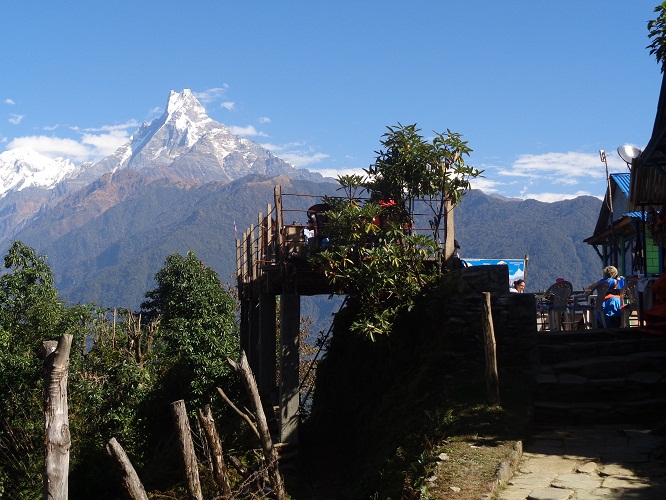 Machhapuchhre or Fish Tail
 View of the Annapurna South, just before Ghandrung
 Tibetan monastery, Ghandrung
 millat seeds
 Larjung, opposite to busy Ghandrung
 last one: on the way down to Phedi